The Titanic, a symbol of luxury and tragedy, has fascinated the world for over a century. Despite countless investigations, many questions about its final moments have remained unanswered. However, a groundbreaking expedition in 2010 provided the first comprehensive map of the Titanic wreck site, revealing new clues about the ship’s catastrophic end. By combining advanced technology with meticulous research, this project has brought to light crucial details, offering a fresh perspective on one of history’s most infamous maritime disasters.
The 2010 Expedition: A Technological Breakthrough
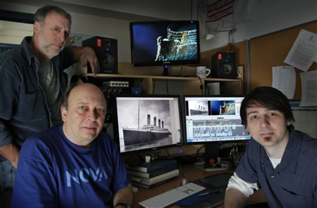
In the summer of 2010, a team of scientists and historians from RMS Titanic Inc. and the Woods Hole Oceanographic Institution embarked on an unprecedented expedition to map the Titanic wreck site. This venture marked a milestone in the long history of Titanic exploration, as it was the first time the entire 15-square-mile debris field had been fully surveyed. Armed with state-of-the-art technology, including Autonomous Underwater Vehicles (AUVs) equipped with high-resolution sonar, the team set out to map the wreckage in more detail than ever before.
While previous efforts to map the site were based on limited access and rudimentary methods, the use of AUVs allowed the team to collect more than 130,000 high-definition images and sonar data, offering an in-depth view of the Titanic wreckage spread across the ocean floor. This technological breakthrough enabled researchers to visualize the site in a way that had never been done before, bringing to light many previously unknown features and clues about the ship’s tragic fate.
Video
Watch New CGI of How Titanic Sank | Titanic 100 to experience a detailed visual recreation of the Titanic disaster using cutting-edge CGI. A must-watch for history and film enthusiasts!
Mapping the Titanic Wreck Site: A 3-by-5-Mile Puzzle
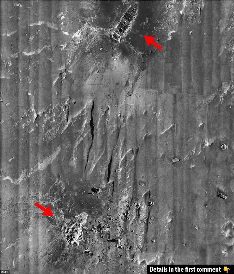
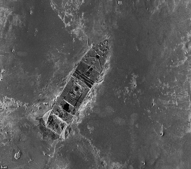
The Titanic wreck site, located about 2.3 miles beneath the surface of the North Atlantic, spans an impressive 3-by-5-mile area. While previous surveys had only mapped small sections of the site, this new expedition captured the full extent of the wreckage, providing a clearer picture of how the ship met its end. Through sonar imaging and 3D photography, researchers were able to generate a comprehensive map that highlights the precise locations of the bow, stern, and various debris scattered across the ocean floor.
The mapping process revealed many startling details. For example, evidence shows that the ship’s stern didn’t simply plummet to the ocean floor; instead, it appears to have rotated in the water like a helicopter blade as it sank. This revelation contradicts previous assumptions about the ship’s final moments and offers a new understanding of the physical forces at play during the sinking.
Key Findings: Significant Clues from the Debris
As the team analyzed the map and the images captured during the expedition, they uncovered a wealth of information that helps answer lingering questions about the Titanic’s destruction. One of the most significant discoveries was the identification of debris that had been scattered in distinct patterns. For instance, the stern section, which had been separated from the rest of the ship, was found to have left clear marks on the ocean floor, supporting the theory that the stern rotated as it sank.
In addition to the marks left by the stern’s rotation, the team also identified several key debris items that helped explain how the ship broke apart. Among the most intriguing discoveries were the remnants of the ship’s third funnel and the surrounding deck debris. These pieces were found in an area that had never been mapped before, providing crucial insight into the ship’s final moments. The position of these items suggested that the Titanic’s break-up was far more violent than previously understood.
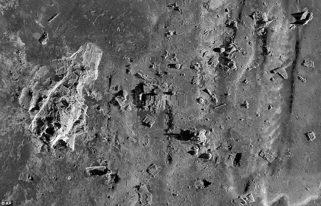
The expedition also uncovered a tangle of deckhouse remains, which had never been seen before. The fact that this debris was located off-set from the bulk of the wreckage further emphasized the catastrophic nature of the ship’s destruction. These findings, along with others like the ship’s massive boilers and a revolving door, help investigators piece together the sequence of events that led to the Titanic’s tragic sinking.
Examining the Wreckage: Forensic Exploration
With the sonar data and high-resolution photographs in hand, researchers were able to conduct a forensic examination of the Titanic wreck site, much like how investigators would analyze a plane crash on land. By studying the position and condition of the debris, scientists were able to make inferences about the ship’s break-up and how the various parts of the ship came to rest on the ocean floor.
For example, the mapping revealed that the Titanic’s boilers, which had once been located deep within the ship’s lower decks, were now scattered across the ocean floor, providing important clues about the ship’s interior structure and the violence of the sinking. The distribution of the debris and the placement of various items helped recreate the events leading up to the ship’s final plunge.
The Titanic at 100: Mystery Solved
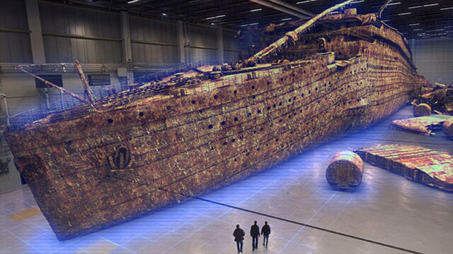
As the world marked the 100th anniversary of the Titanic’s sinking in 2012, the discoveries made during the 2010 expedition were presented in a special documentary titled Titanic at 100: Mystery Solved, aired by the History Channel. The documentary, which featured footage from the expedition and computer simulations of the sinking based on the new data, offered viewers a groundbreaking look at the wreckage and provided new insights into the ship’s destruction.
The findings from the 2010 expedition have led to a deeper understanding of the Titanic’s final moments, and the mapping project has provided a wealth of information for historians, archaeologists, and enthusiasts alike. The documentary not only revealed new theories about the ship’s sinking but also showed how modern technology has allowed researchers to explore and document the wreck site in unprecedented detail.
Video
Watch Investigating the Titanic (Full Episode) | Drain the Oceans to dive deep into the mysteries surrounding the Titanic’s sinking with expert analysis and stunning visuals. A must-watch for Titanic history buffs!
Conclusion: How the Titanic Mapping Changes Our Understanding
The full mapping of the Titanic wreck site has revolutionized the way we understand the ship’s tragic end. For the first time, researchers have been able to create a detailed, comprehensive map of the entire 3-by-5-mile debris field, offering new clues about the ship’s break-up and the events leading to its sinking. The expedition, which utilized cutting-edge technology like AUVs and sonar imaging, has uncovered a wealth of information that will continue to shape the study of the Titanic for years to come.
As new discoveries are made and the wreckage is further explored, the Titanic’s mystery continues to captivate the world. The complete mapping of the wreck site has opened a new chapter in the ongoing exploration of the Titanic, allowing us to piece together the story of the ship and its passengers in ways that were once unimaginable.